 STORY TO TELL...? Please share it with us, using the "comments" box (below).
Showing posts with label St Mary Magdalene. Show all posts
Showing posts with label St Mary Magdalene. Show all posts
Recent Photo : St Mary's Church
STORY TO TELL...? Please share it with us, using the "comments" box (below).
Recent Photo : Sensory Garden
 Hucknall's Sensory Garden is in the grounds of St Mary's Church, close to the Market Square.
STORY TO TELL...? Please share it with us, using the "comments" box (below).
Recent Photo : Hucknall Market
 Some well-stocked stalls on Hucknall's Friday Market.
St Mary's Church can be seen in the top-right of the picture, and the Public Library can be seen top-left.
STORY TO TELL...? Please share it with us, using the "comments" box (below).
Archive Photo : Town Centre
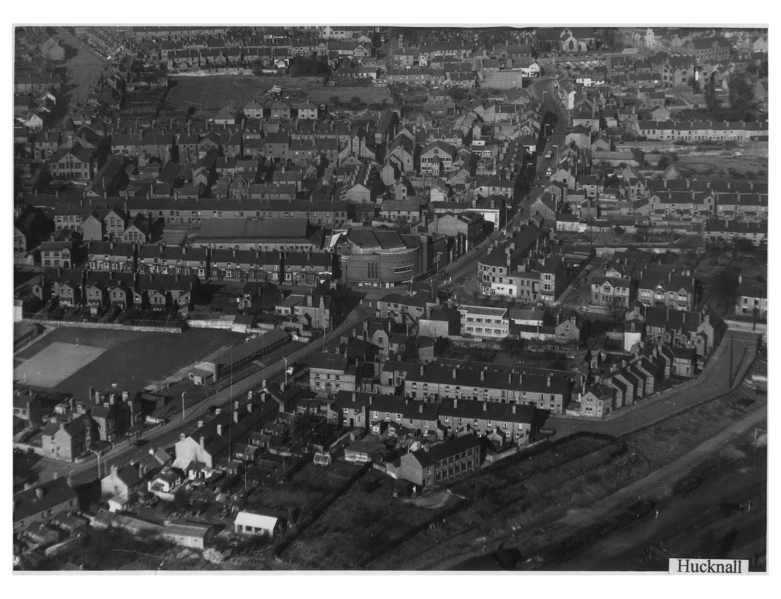 This aerial photo was taken from the south-east, looking towards Hucknall's town centre.
The Byron Cinema can clear be seen in the centre of the picture, standing at the crossroad of High Street (top-right), Portland Road (bottom-left), Duke Street (middle-left), and Station Road (middle-right).
The L-shaped road (mid-right) is Bolsover Street). In the bottom-right corner of the picture are railway trucks, indicating sidings from the main railway line. This area is now occupied by Corman's Factory Shop, some industrial units, and Tesco petrol station.
To the top of the picture, the parish church can just be seen. Market stalls are also visible.
STORY TO TELL...? Please share it with us, using the "comments" box (below).
Archive Photo : Aerial Photo
 This aerial photo is taken from the north-west of the town, and shows annesley road in the bottom-centre.
The parish church and market place are in the centre of the picture. High Street is in the upper-middle part of the picture.
The area which is now "Piggins Croft" car park appears to be an open field, and can be seen above-right of the church.
STORY TO TELL...? Please share it with us, using the "comments" box (below).
Archive Photo : Aerial Photo
 This aerial photograph shows the north and central areas of the town. Annesley Road is in the top-left of the the picture, and Portland Road is in the bottom-right.
Sandy Lane and Central Avenue form the "V" in bottom-left of the picture, at the point where they meet Watnall Road.
St Mary's Church and the market square can be seen in the centre of the photo.
The colliery in the top-right of the photo is served by the railway line, which continues in use as "The Robin Hood Line".
The other railway line (in the left of the picture) no longer exists; however, its path through Hucknall can still be seen on current satellite images.
STORY TO TELL...? Please share it with us, using the "comments" box (below).
Recent Photo : St Mary's Church
 The Parish Church of St Mary Magdalene, as seen from the south side.
STORY TO TELL...? Please share it with us, using the "comments" box (below).
Subscribe to:
Posts (Atom)
